
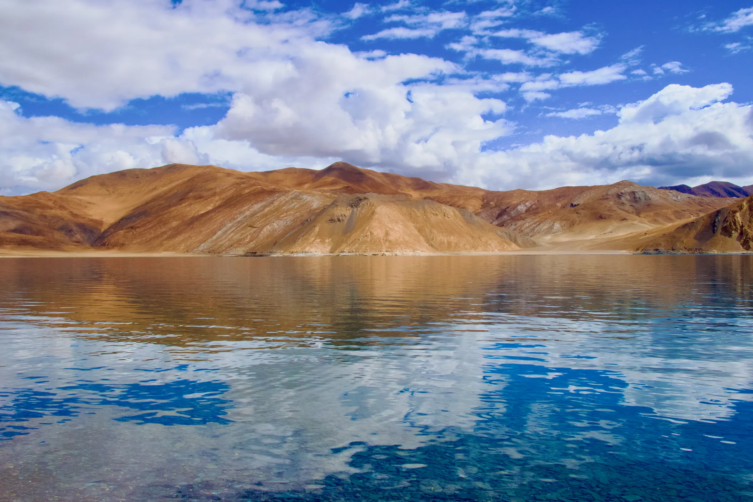
Pangong Tso is a lake in Leh district, Ladakh. Kashmir Travel Guide is an independent travel guide to Kashmir, Jammu and Ladakh, published at kashmirtravelguide.co.in, and this is its entry for Pangong Tso.
This Pangong Tso travel guide covers the long blue lake on the China border at 4,300 m: the drive over Chang La, the shore villages of Spangmik, Man and Merak and their camps, what the lake does through the year including the winter freeze, the permit and fee rules, and how to reach Pangong Tso from Leh.
Summary
In short: plan 1–2 days in Pangong Tso, come between All year, arrive by air or rail.
| Also written | Pangong Lake, Pangong Tso Lake, Spangmik |
|---|---|
| Coordinates | 33.9077° N, 78.4573° E Directions ↗ |
Published Last reviewed How this entry is checked
Things to do in Pangong Tso
Pangong Tso is a brackish lake 134 km long and up to 5 km wide at about 4,300 m, of which roughly a third lies in India and the rest in Chinese-held Tibet. It is the most photographed place in Ladakh, for the colour of the water, which turns from turquoise to deep blue to grey as the light changes across the bare hills, and, since the film 3 Idiots ended here in 2009, for the sheer number of visitors who come to see it. The Indian shore road runs from the Tangtse side past Lukung and Spangmik to Man and Merak, and further along a restricted stretch towards Chushul.
The shore at Spangmik, Man and Merak
Spangmik is the first village on the shore and the one most day-trippers reach: tents and huts on the gravel, the film props, a few tea stalls. Man and Merak, 15 to 25 km further, are quieter, with homestays in the villages and a longer view down the lake; staying at either is the better night. Walk the shore at dawn, when the water is still and the light comes across from the Chinese side, and again at dusk when the hills go red.
Birds and the Changthang
Bar-headed geese and Brahminy ducks breed on the marshes at the lake's western end in summer, and black-necked cranes feed there; the marmots by the road are tame to the point of nuisance, and feeding them is prohibited. The high plateau around the lake is the Changthang, grazed by the Changpa with their pashmina goats, and kiang, the wild ass, are common on the approach.
The drive over Chang La
The road from Leh climbs the Indus to Karu, then the Chang La at about 5,360 m, one of the highest motorable passes in the world, before dropping through Durbuk and Tangtse to the lake. The pass is the reason the trip is not for the first day in Ladakh; the drive is about 160 km and five to six hours. A newer road links Pangong to Nubra via Shyok, so the two can be done as one loop without returning to Leh.
Best time to visit Pangong Tso
Pangong Tso is open to visitors in every month, but its character changes completely; the best time to visit is May to September, when the lake is liquid, the camps are open and the road is reliable.
- May to September, the best time: blue water, all camps and homestays open, the geese on the marsh; June to August is very busy at Spangmik. Nights are near freezing even in July.
- October and November: cold, clear and empty, with the camps closing in October; homestays in the villages stay open. Chang La can close for days after snow.
- December to March: the lake freezes solid by January and the shore is a white desert at −20 °C or below; a winter visit is possible with a heated homestay and a driver who knows the road, and the frozen lake is a spectacle for the few who come. The Pangong frozen-lake marathon runs in February.
- April: the ice breaks up; the road is usually open but the camps are not yet.
A night, not a day trip
Day trips to Pangong exist but mean twelve hours in a car for an hour at the water; the lake is at its best at dawn and dusk. Stay a night at Spangmik, Man or Merak, or make it the first leg of the Pangong–Shyok–Nubra loop, which gives two nights out from Leh and no repeated road. Camps are tents with beds and bathrooms; homestays are village houses with shared facilities and far warmer welcomes.
How do you get to Pangong Tso?
Working out how to reach Pangong Tso means one road from Leh over Chang La, or the Shyok road from Nubra.
By road from Leh: about 160 km and five to six hours via Karu, Chang La, Durbuk and Tangtse; taxis at the Leh stand run at fixed union rates, shared taxis leave early morning in season, and motorcycles are hired in Leh. From Nubra: the Shyok valley road from Diskit to Tangtse, about 170 km, open in summer and subject to closure by the river in the monsoon. By air: Leh, then the road. There is no public bus that suits a visitor's timing.
Leh is the base; Nubra Valley is the natural pairing.
What should you know before visiting Pangong Tso?
These Pangong Tso travel tips assume a night at 4,300 m after a pass at 5,300.
- Do not come on your first or second day in Ladakh; acclimatise in Leh first.
- Carry the environment and development fee receipt and photo identification; they are checked at Tangtse.
- Pack for winter whatever the month: the wind off the water is bitter after sunset.
- Fill fuel at Karu; there is none between there and the lake.
- Expect no phone signal beyond Tangtse except patchy postpaid BSNL; tell someone your plan.
- Bring cash for camps, tea and homestays.
- Do not drive on the shore, feed marmots or leave anything behind; the lake is a fragile wetland.
Common questions
What should I pack for a night at Pangong?
Everything you would take for a winter night, whatever the month: a down jacket, hat and gloves, thermal layers to sleep in, a torch, cash, and any medication you use for altitude. Camps provide bedding but no heating.
Is a day trip to Pangong worth it?
It is a long day for a short look. If a day is all you have, leave Leh before dawn; but a night at the lake, ideally as part of the loop through Nubra, is the trip worth making.
Which is better, Pangong or Tso Moriri?
Pangong is bigger, bluer and busier; Tso Moriri is higher, quieter and wilder. Most first visits choose Pangong; a second trip, or a longer one, adds Tso Moriri.
Where does this information come from?
This guide is written from official and locally verified sources, and leaves a figure out rather than guessing at it. Every entry shows the day it was published and the day a person last checked it. For anything that moves with the day, go to the authority that publishes it:
- Flights and airport information: Airports Authority of India
- Train times and availability: Indian Railways
- Weather warnings and forecasts: India Meteorological Department
- This guide on mobile: App Store and Google Play