
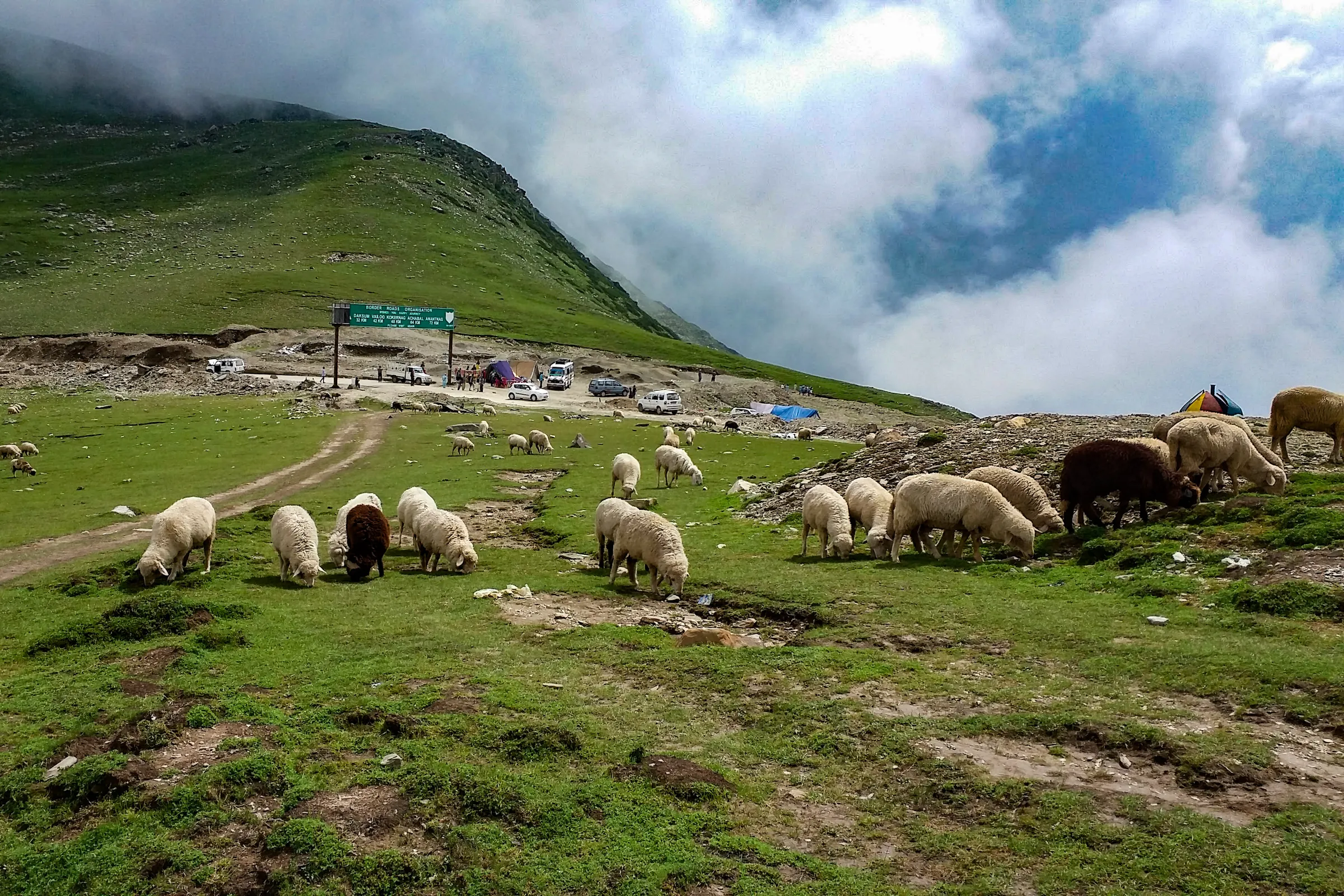
Sinthan Top is a hill station in Anantnag district, Kashmir Valley. Kashmir Travel Guide is an independent travel guide to Kashmir, Jammu and Ladakh, published at kashmirtravelguide.co.in, and this is its entry for Sinthan Top.
This Sinthan Top travel guide covers the 3,800 m road pass between the Kashmir Valley and Kishtwar, about 130 km from Srinagar beyond Kokernag and Daksum: what the pass offers, the summer snow, the road season, and the closure to tourists that still applied in the summer of 2026.
Summary
In short: plan 1–2 days in Sinthan Top, come between All year, arrive by air or rail.
| Also written | Sinthan Pass, Sinthan |
|---|---|
| Coordinates | 33.5824° N, 75.5111° E Directions ↗ |
Published Last reviewed How this entry is checked
Things to do at Sinthan Top
Sinthan Top is a pass, not a town. The Anantnag–Kishtwar national highway crosses the Pir Panjal here at about 3,800 m, and the road head on the crest has become a destination in itself: a place where a car from the valley can reach snow in June, look south over the Chenab valley and north back over the forests of the Bringi. There are no buildings beyond seasonal tea tents, and the nearest beds are at Daksum and Kokernag, 37 and 48 km back down the road.
The pass and the view
Most visitors stop at the road head, walk a little way up the slopes on either side and take in the two views. The ridges above the pass are open grass and scree, easy to walk on in summer, and half an hour's climb opens the panorama considerably. Go slowly: the altitude is real, and the road brings you up from 2,400 m at Daksum in an hour.
Snow in summer
The pass holds snow into June and sometimes July, which is the reason for its popularity with families from the valley and from Jammu. Expect snow play, sledges and tea tents in early summer, and a bare green pass by August. Snow arrives again in October and closes the road for the winter.
The road down to Kishtwar
Beyond the pass the highway descends about 80 km to Kishtwar town in the Chenab valley. It is a serious mountain road with long unfenced drops, and it is the route to Warwan, Marwah and the Chenab valley beyond. Treat a crossing to Kishtwar as a separate journey needing a full day, a good driver and an early start, not an extension of a snow outing.
Best time to visit Sinthan Top
The road over the pass usually opens in late spring once the snow is cut and closes again with the autumn snows; the exact dates vary each year and are set by the road authorities. Within that window, June is the month for snow at the top, July and August for green slopes and cloud, September and early October for the clearest views. Afternoons bring cloud and wind to the crest in every month, so arrive before noon.
Closed to tourists since 2025
Sinthan Top and Daksum were shut to visitors after the April 2025 attack in Pahalgam. Surveys of Kashmir's tourist sites published on 10 and 15 July 2026 still listed both among the places closed to tourists. The highway over the pass is a through road to Kishtwar and may carry traffic while the tourist spot is listed as closed, so open road is not the same as open access; ask before you set out. This guide was checked on 20 September 2026 and found no report of a reopening.
A day from the valley
When it is open, Sinthan Top is a long day from Srinagar, four to five hours each way, or a more comfortable one from Pahalgam via Anantnag. The natural shape is Kokernag on the way up, the pass by late morning, and Daksum for a late lunch on the way down. Staying the night at Daksum or Kokernag turns it into an easy two days and gets you to the crest in the clear morning air.
Photo credit
Hero photograph: Madhumita Das, CC BY-SA 4.0, via Wikimedia Commons; cropped and resized.

How do you get to Sinthan Top?
There is one answer to how to reach Sinthan Top: by road up the Bringi valley from Anantnag, through Kokernag and Daksum, on the national highway that continues to Kishtwar.
From Srinagar the distance is about 130 km and the drive four to five hours; from Anantnag about 73 km; from Kokernag 48 km and from Daksum 37 km, the last stretch a steady climb of hairpins from the forest to the bare crest. The road is paved but narrow and exposed near the top.
By air: Srinagar Airport, about 135 km. By rail: Anantnag, on the Kashmir Valley line; check current services and continue by road.
There is no scheduled bus to the pass; Kishtwar-bound buses cross it without stopping. A hired car from Srinagar, Pahalgam or Anantnag is the practical choice, with a driver who knows the road. Fill the tank in Anantnag. If you have not chosen a base, our Srinagar guide covers the options.
What should you know before visiting Sinthan Top?
These Sinthan Top travel tips are for a drive to 3,800 m and back in a day, which is higher than most visitors have been.
- Confirm the pass is open to tourists and the road is clear before you leave; both have been closed at different times since 2025.
- Take altitude seriously. Drink water, move slowly at the top, and turn back if anyone has a headache, nausea or breathlessness. Children and older travellers feel it first.
- Carry warm clothing, sunglasses and sunscreen even in July; the crest is cold, windy and bright.
- Bring food and water. Tea tents operate in season; there is nothing reliable above Daksum.
- Start early and be off the pass by early afternoon, before cloud and wind arrive.
- Take every wrapper and bottle back with you; the pass has no waste collection.
Common questions
Is Sinthan Top open right now?
Check before you go. Reports from July 2026 listed it as still closed to tourists after the 2025 shutdown, and no reopening had been reported by 20 September 2026. The road itself may be open to through traffic, which is not the same thing.
How high is Sinthan Top?
About 3,800 m, or roughly 12,500 ft. That is high enough for altitude sickness on a day trip from the valley, so go up slowly and come down if anyone feels unwell.
Can I see snow at Sinthan Top in summer?
Usually in June and sometimes into July, once the road opens. By August the pass is green.
Where does this information come from?
This guide is written from official and locally verified sources, and leaves a figure out rather than guessing at it. Every entry shows the day it was published and the day a person last checked it. For anything that moves with the day, go to the authority that publishes it:
- Flights and airport information: Airports Authority of India
- Train times and availability: Indian Railways
- Weather warnings and forecasts: India Meteorological Department
- This guide on mobile: App Store and Google Play