
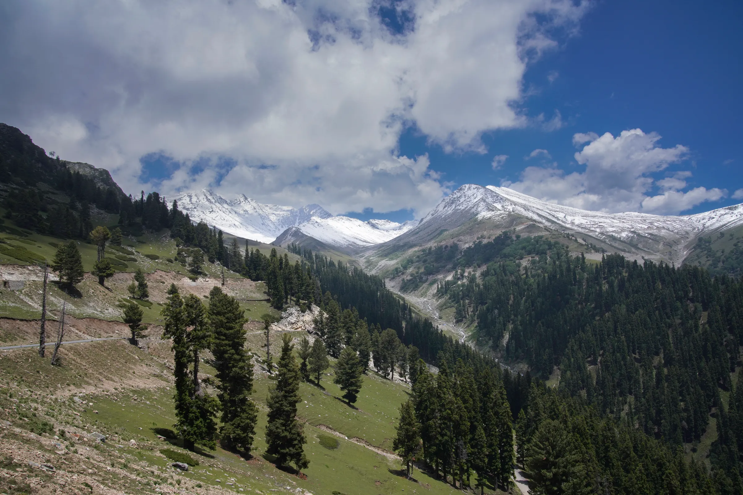
Daksum is a hill station in Anantnag district, Kashmir Valley. Kashmir Travel Guide is an independent travel guide to Kashmir, Jammu and Ladakh, published at kashmirtravelguide.co.in, and this is its entry for Daksum.
This Daksum travel guide covers the forested riverside halt in the Bringi valley of Anantnag district, about 100 km from Srinagar on the road from Kokernag to Sinthan Top: what is there, how it pairs with Kokernag, and the closure to tourists that still applied in the summer of 2026.
Summary
In short: plan 1–2 days in Daksum, come between All year, arrive by air or rail.
| Also written | Daksum valley |
|---|---|
| Coordinates | 33.6092° N, 75.4148° E Directions ↗ |
Published Last reviewed How this entry is checked
Things to do in Daksum
Daksum is a scatter of huts and hamlets at about 2,440 m where the road from Kokernag leaves the orchards behind and enters the pine forest of the upper Bringi valley. The river runs fast and cold beside the road, the slopes are dense with conifers, and the range that closes the valley to the south-east carries snow for most of the year. There is no town: Daksum is a place to walk, fish and breathe rather than to sightsee.
The river and the forest
The Bringi is the point. Walk upstream along the bank or on the forest tracks above it, where the trees give shade even at midday and the sound of the water never stops. Anglers come for the trout; a licence from the Fisheries Department is required, and the season and beats are set by the department. The Rajparian wildlife sanctuary lies in the hills nearby; enquire locally about access, since it is not an open park.
The road on to Sinthan Top
Daksum is the last halt before the road climbs about 37 km to Sinthan Top, the 3,800 m pass into Kishtwar. When the pass is open, from late spring to autumn, that climb is the reason many visitors come through Daksum at all. Treat the pass as a separate outing with its own page, and treat Daksum as the place to stop for tea, a walk and a night on the way.
Pair it with Kokernag
Kokernag, with its springs, botanical garden and trout farm, lies about 20 km back down the same road, and Achabal's Mughal garden is beyond it. Kokernag in the morning, Daksum for a walk and lunch by the river, and the return to Srinagar or Pahalgam is a full, unhurried day when the valley is open.
Best time to visit Daksum
May to October is the season. The river is highest and loudest in May and June on snowmelt; July and August bring rain to the forest; September and October give clear air and the first colour on the broadleaf trees among the pines. Snow closes the road beyond Daksum in winter and can reach Daksum itself.
Closed to tourists since 2025
Daksum and Sinthan Top were shut to visitors after the April 2025 attack in Pahalgam. Surveys of Kashmir's tourist sites published on 10 and 15 July 2026 still listed both among the places closed to tourists. The road through Daksum is a national highway to Kishtwar and may carry through traffic even when the tourist spot is closed, so a passing car is not proof that visitors are admitted. This guide was checked on 20 September 2026 and found no report of a reopening; confirm with the Anantnag district administration before planning a visit.
Stop or overnight?
When it is open, most visitors treat Daksum as a stop of an hour or two between Kokernag and the pass. A night here suits anglers, walkers and anyone who wants to cross Sinthan Top early in the morning. Accommodation is a handful of government huts and simple guesthouses; confirm that a unit is operating and whether meals are served before you rely on it. Kokernag has more choice.
How do you get to Daksum?
Planning how to reach Daksum is simple: it lies on the Anantnag–Kokernag–Kishtwar road, about 20 km beyond Kokernag, and every route to it passes through Anantnag.
From Srinagar the distance is about 100 km and the drive around three hours: south on the national highway to Anantnag, then east up the Bringi valley through Kokernag. From Pahalgam it is roughly 75 km via Anantnag. The road is paved but narrow beyond Kokernag.
By air: Srinagar Airport, about 105 km. By rail: Anantnag, on the Kashmir Valley line, about 42 km; check current services and continue by road.
Buses and shared taxis run from Anantnag to Kokernag, and less often on to Daksum and towards Kishtwar; confirm the last return service before relying on one. A hired car for the day from Srinagar or Pahalgam is the practical choice, and the fare should cover the Kokernag stop. If you have not chosen a base, our Srinagar guide covers the options.
What should you know before visiting Daksum?
These Daksum travel tips are for a riverside halt with almost no facilities, on a road that goes on over a high pass.
- Confirm Daksum is open to tourists before you leave; it has been closed since 2025.
- Bring food and water. Tea stalls operate in season; proper meals mean Kokernag or Anantnag.
- Dress for a forest valley at 2,400 m: a warm layer and a waterproof even in July, and shoes with grip on wet tracks.
- If you plan to fish, get the licence in advance; it cannot be bought on the bank.
- Fill the tank in Anantnag if continuing over Sinthan Top; there is no fuel beyond Kokernag.
- Take every wrapper and bottle back with you.
Common questions
Is Daksum open right now?
Check before you go. Reports from July 2026 listed it as still closed to tourists after the 2025 shutdown, and no reopening had been reported by 20 September 2026. The Anantnag district administration can confirm the position.
How far is Daksum from Sinthan Top?
About 37 km by road, climbing from roughly 2,400 m to 3,800 m. Allow an hour and a half each way when the pass is open.
Is there anywhere to eat at Daksum?
Tea stalls and a hut cafeteria in season, and little else. Kokernag, twenty minutes back down the road, has the nearest simple restaurants, so most visitors carry a picnic.
Where does this information come from?
This guide is written from official and locally verified sources, and leaves a figure out rather than guessing at it. Every entry shows the day it was published and the day a person last checked it. For anything that moves with the day, go to the authority that publishes it:
- Flights and airport information: Airports Authority of India
- Train times and availability: Indian Railways
- Weather warnings and forecasts: India Meteorological Department
- This guide on mobile: App Store and Google Play