
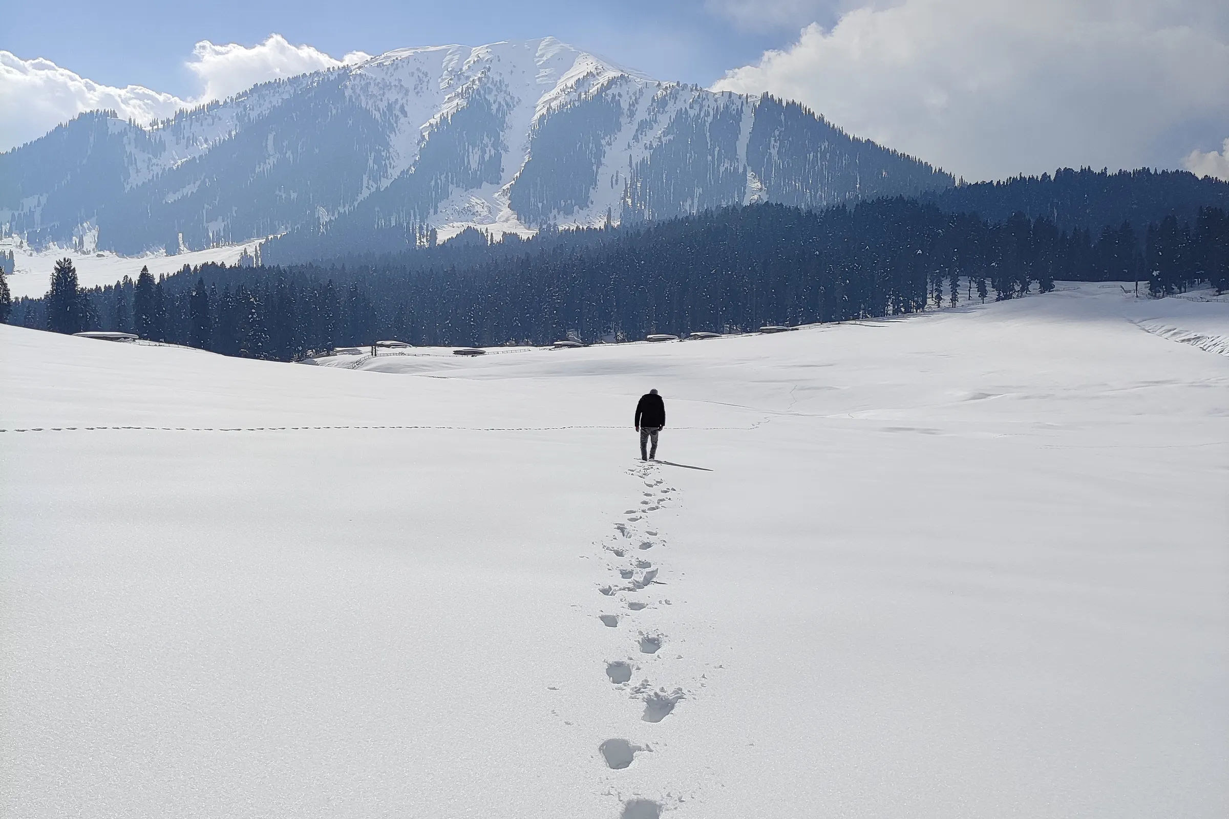
Doodhpathri is a hill station in Budgam district, Kashmir Valley. Kashmir Travel Guide is an independent travel guide to Kashmir, Jammu and Ladakh, published at kashmirtravelguide.co.in, and this is its entry for Doodhpathri.
This Doodhpathri travel guide covers a high meadow in Kashmir’s Budgam district, about 42 km from Srinagar: what lies beyond the first lawn, which season suits you, and what to confirm before you set off.
Summary
In short: plan 1 day in Doodhpathri, come between All year, arrive by air or rail.
| Also written | Doodpathri, Dudhpathri |
|---|---|
| Coordinates | 33.8500° N, 74.5600° E Directions ↗ |
Published Last reviewed How this entry is checked
Things to do in Doodhpathri
Doodhpathri is a bowl of open grassland at roughly 2,730 m in the Pir Panjal, ringed by conifers and cut by a cold, fast stream. Nobody lives here year-round. Shepherds bring livestock up for the warm months and leave before the snow, so what you find is pasture, water and forest rather than a town with sights to tick off.
Walk the main meadow and the stream
Most visits begin and end on the central meadow, a short distance from where vehicles stop. The stream that crosses it runs white over its boulders, and local tradition ties the name — usually translated as “Valley of Milk” — to the Kashmiri saint Sheikh Noor-ud-din Noorani, who is said to have struck the ground here for water. Walk upstream until the picnic groups thin out; the ground is gentle and the distance is yours to choose. Pony rides are offered for those who would rather not walk. Agree the route, the turning point and the full price before mounting.
Tangnar, Mujpathri and Palmaidan
Three named spots sit close enough to combine with the meadow. Tangnar comes first, about 2 km before you arrive: small wooded valleys of deodar and pine that most cars drive straight past. Mujpathri, a hamlet roughly 3 km away, stands on the bank of the Shaliganga river. Palmaidan, about 5 km off, is a boulder-strewn grazing ground where herders gather with their animals in summer.
Pick one or two. Ask at the road head how each is currently reached and whether your own vehicle may continue or a local one is required, since arrangements are set locally and can change.
Treat Diskhal and Tosamaidan as separate outings
Diskhal is a ridge-top meadow overlooking the Ashtaar glacier, around 10 km on foot from the Shaliganga stream. That is a full mountain day needing an early start, proper footwear and someone who knows the trail, not an add-on to a picnic. Tosamaidan, the large meadow to the west that opened to visitors in 2016, likewise deserves its own plan.
Best time to visit Doodhpathri
For green pasture and wildflowers, plan between May and September; the Directorate of Tourism singles out June and July for flowers. Days are cool by plains standards even in midsummer, and afternoon cloud often builds over the ridge, so mornings give the clearest views.
- May and early June: snow lingers on the upper slopes and the grass is new. Side tracks may still be soft or blocked.
- Late June to August: the fullest grass and the most visitors, along with monsoon-season rain. This is when the weather risk described below is highest.
- September and October: thinner crowds and clearer air, with cold arriving quickly after sunset.
- Winter: the district administration’s pages still describe the area as inaccessible under snow. That is no longer the whole picture. The tourism department staged a snow carnival at Parihas Maidan here in February 2026, and a ski drag lift was under construction when officials inspected it in December 2025. Winter visits happen, but they depend on road clearance on the day; this guide does not promise that the road or any lift is operating.
Doodhpathri does close, sometimes for weeks
Two recent closures are worth knowing about before you build a fixed itinerary.
- It was among the destinations shut for a security review in April 2025, and its reopening was announced only on 16 February 2026.
- In late July 2026 the Doodhpathri Development Authority closed it to visitors because of continuous rain and the risk of flash floods and landslides on the approach roads. It reopened on 21 August 2026.
Both are precedents rather than a calendar. They do show that a dated confirmation from your driver, hotel or the authority on the morning of travel is worth more than any guide, this one included. Keep a second plan for the day.
Day trip or overnight stay?
A day trip from Srinagar is the normal shape of a visit, and for most travellers the right one. Leave early, give the meadow and one side spot your unhurried attention, and start back with daylight in hand.
Staying overnight is possible but narrow. The state tourism corporation, JKTDC, lists a handful of huts and a dormitory, and itself notes that there is no proper market or hotel here. Another official tourism page says there is no accommodation at all, so confirm directly that the unit you are booking is open for your dates, heated if you need it, and serving meals. Camping needs permission from the authorities; do not pitch on grazing land on a tour operator’s say-so.
If you want ski lifts, a choice of hotels and restaurants, Gulmarg is the better fit. Come here for open space and very little else.
How do you get to Doodhpathri?
Working out how to reach Doodhpathri is simple in outline: there is no airport, station or bus terminus at the meadow, so every visit ends with a road journey, and almost all of them start in Srinagar. Two roads lead up.
- Via Budgam and Khansahib: Srinagar – Budgam – Khansahib – Raiyar – Doodhpathri, about 45 km. This is the usual route.
- Via Magam and Beerwah: Srinagar – Magam – Beerwah – Arizal – Doodhpathri, about 50 km, leaving the Gulmarg road at Magam.
Distances are the district administration’s figures and vary with your starting point. Official sources disagree on driving time, from about an hour to nearer two; the final climb is a narrow hill road, so plan on the longer figure and do not schedule a flight for the same evening.
By air: Srinagar Airport is roughly 40 km away. By rail: Budgam station at Ompora, on the Kashmir Valley line, is listed at about 35 km; check current train services and arrange the road transfer separately.
For a hired car, confirm that the quote covers the return, waiting time, parking and any side spots you intend to visit. Travelling without a private car means changing vehicles in the Budgam area; this guide cannot confirm a scheduled public service to the meadow itself, so settle your return before relying on one. If you have not yet chosen a base, our Srinagar guide covers where to stay.
What should you know before visiting Doodhpathri?
These Doodhpathri travel tips assume a single day out from Srinagar to a place with no town behind it. Whatever you forget, you will go without.
- Carry water, food, any medicines and some cash. The development authority has built roadside toilets and a cafeteria, and tea stalls operate in season, but none of this should be your only plan.
- Dress in layers and bring a waterproof. The meadow sits more than a kilometre higher than Srinagar, and the forecast for the city says little about conditions here.
- Wear shoes with grip. Grass, stream-side boulders and pony tracks are slippery after rain.
- Ask whether an entry or parking charge applies and request a receipt. No tariff has been verified for this guide, and no pony or vehicle rate quoted to you on the spot is an official one unless you are shown the rate list.
- Download maps and booking details beforehand. Mobile coverage in the area has not been confirmed for this guide.
- Take every wrapper and bottle back down. This is working pasture: keep clear of flocks and dogs, and do not feed or chase animals for photographs.
Common questions
Are Doodhpathri, Doodpathri and Dudhpathri the same place?
Yes. All three are English spellings of one name, and official sources themselves alternate between them. When booking a hut or a driver, confirm the district — Budgam — rather than relying on the spelling.
Is Doodhpathri manageable with young children or older relatives?
The central meadow is close to where vehicles stop and the ground is gentle, which makes it one of the easier mountain outings from Srinagar. The limits are altitude, weather that turns quickly and the absence of a clinic or pharmacy. Keep the day short, keep everyone warm, and skip the side spots if anyone is tiring.
Can I get a meal there?
Expect tea, snacks and simple cooked food from seasonal stalls and the roadside cafeteria, not restaurants. Stalls shut when the area is closed and thin out late in the year, so a packed lunch is the safer choice outside the summer peak.
Where does this information come from?
This guide is written from official and locally verified sources, and leaves a figure out rather than guessing at it. Every entry shows the day it was published and the day a person last checked it. For anything that moves with the day, go to the authority that publishes it:
- Flights and airport information: Airports Authority of India
- Train times and availability: Indian Railways
- Weather warnings and forecasts: India Meteorological Department
- This guide on mobile: App Store and Google Play